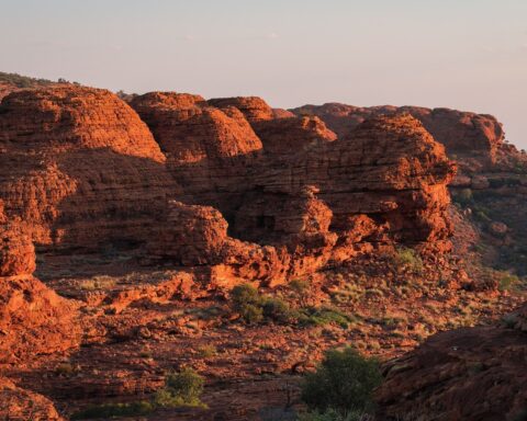
The Larapinta Trail is an extended bushwalking trail that takes hikers from the Alice Springs Telegraph Station, through the stunning West MacDonnell Ranges, ending at Mount Sonder. It is regarded as one of the best and most scenic trails in Australia, but also one of the most challenging.
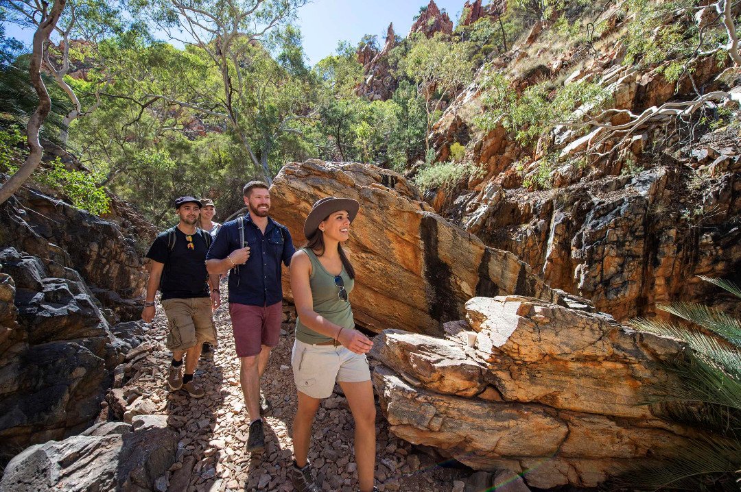
Before you set off, planning and preparation are essential. The trail should only be attempted by experienced hikers with a good level of physical fitness. Figure out a plan and ensure that you pack all of the essentials. Allow at least 13-15 days to complete your 223KM excursion.

The trail is split into 12 sections. The first takes you from the telegraph station close to Alice Springs town centre to Simpsons Gap, via Euro Ridge which provides lovely views of the town. Once you arrive, it is only a short walk from the campsite to the beautiful waterhole.
Section two is relatively easy and delivers you to Jay Creek, home to breathtaking scenery and a campsite. Section three from Jay Creek to Standley Chasm is more difficult, offering a choice of two routes: the high route which promises astounding views over the vast expanse below, or the low route that meanders up a dry creek bed. Some trickier sections towards the end deliver you to a campsite close to the picturesque chasm, which is magnificent to see, and also an important women’s dreaming site.

Section four requires you to tackle a steep ascent to Brinkley Bluff, where you will be rewarded with unrivalled 36-degree views of your impressive surroundings, before descending to a dry creek bed which leads to Birthday Waterhole. Section five is one of the most challenging – dramatic climbs, sheer drops, and loose rocks leave no room for error. However, it’s worth it for the exquisite views of the valley. This section ends at High Valley, which then leads to Ellery Creek during section six. Although the terrain is flat, this section is long and windy. Ellery Creek Big Hole provides a delightful place to cool off.
Section seven provides rocky ascents and plenty of ups and downs. This beautiful section of the trail ends at sacred Serpentine Gorge. Section eight will take you from the gorge to the fabulous lookout at Counts Point, and onwards to Serpentine Chalet. Section nine towards Ormiston Gorge is strenuous, however, the views are spectacular. Stop at sacred Inarlaga Gorge and the striking summit of Mount Giles. Ormiston Gorge itself is one of the most well-known stops on the trail, admired for its gorgeous swimming hole and astounding scenery. Section ten is shorter, with just a few small ascents and descents before you arrive at Finke River.

Section eleven offers your first views of Mount Sonder as you meander through small gullies and dry riverbeds, ending at Redbank Gorge, home to a stunning waterhole. Section twelve is the last leg of the journey, with a final climb up to the summit of Mount Sonder, where you can relax and enjoy extensive views over the peaks and plains of the ranges.
Download AllTrails, and start planning your trek through the heart of the Red Centre today. Adventure awaits!